Showing posts with label flood. Show all posts

Saturday, September 28, 2013

Flood damage repair funds for low income rural NM homeowners

Release No. 13-76-01                                                                                      For Immediate Release  ­
Applications to Be Taken for Home Repairs Caused by 
Rain Damage and Flooding in Rural New Mexico

USDA RD Prepared to take applications from qualified very low income homeowners

 (September 17, 2013 Albuquerque, NM) USDA Rural Development State Director Terry Brunner announced today his staff is prepared to provide information and take applications to help fix homes damaged in rural communities devastated from the recent rain storms.

In making the announcement Brunner said, “I’ve directed my staff to be prepared to provide as much service as possible to help qualified homeowners fix their homes damaged by the rain fall and flooding.”  Brunner added, “We will do everything we can to help those homeowners that need the most help to fix their homes.”

The funding is through USDA Rural Development’s Section 504 housing loan and grant program which provides financial help to very low income home owners living in a rural community to rehabilitate their home.  The program can provide a $7,500 grant to rural residents who are 62 years old or older who own their home and have a very low income.  The money can be used to fix a roof and other types of repairs including window repair and other needed necessities. The 504 loan program is also available to all very low income homeowners also living in a rural community. It provides up to a $20-thousand loan for one percent interest to repair or refurbish a home.

“This program will be especially helpful to those low income residents that need additional financial support because they don’t have the insurance to cover the damage that was done to their home because of the recent rains,” said Brunner.

Those wanting to apply for the Section 504 housing repair program should contact one of USDA Rural Development’s offices to see if they qualify for a loan or a grant and to set up an appointment to make an application.

Aztec
1427 West Aztec Blvd Suite 1
Aztec, NM 87410
505-334-3090 Extension #4

Las Cruces
2510 Telshor
Las Cruces, NM 88011
575-522-8775 Extension #4

Las Vegas
1927-A North 7th Street
Las Vegas, NM  87701
505-425-3594 Extension #4

Los Lunas
2600 Palmilla Road Suite C
Los Lunas, NM 87031
505-865-4643 Extension #4

Roswell
1011 Atkinson Ave.
Roswell, NM 88203
575-622-8745 Extension #4


USDA, through its Rural Development mission area, has a portfolio of programs designed to improve the economic stability of rural communities, businesses, residents, farmers and ranchers and improve the quality of life in rural America. USDA has made a concerted effort to deliver results for the American people, even as the Department implements sequestration – the across-the-board budget reductions mandated under terms of the Budget Control Act.

 USDA has already undertaken historic efforts since 2009 to save more than $828 million in taxpayer funds through targeted, common-sense budget reductions. These reductions have put USDA in a better position to carry out its mission, while implementing sequester budget reductions in a fair manner that causes as little disruption as possible.


Tuesday, September 17, 2013

Catron County flood report for Gov. Martinez

Catron County Flood Response
Incident Status   9-17-13   1600 Hours
Issued by: Catron County, NM

Arrival         1600-1630
Introductions  - Blue Front Café.
Review Work at Highway 180 Bridge in Glenwood.
Look at flood damage to private property along Whitewater Creek – Circle Drive.
Drive to Highway 180 bridge at Alma.
Look at flood damage to private property up Mineral Creek.
Return to Blue Front Café.
Overflight of Hwy 159 into Mogollon.
Possible overflight of Willow Creek Subdivision.

Alan Beaty – Incident Commander
Lorenzo  Espinoza       DHSEM Liaison
Bucky Allred  -     County Commissioner District #3
Cathlyn Snider – County Manager
Doug Boykin – Public Information

STATUS
In response to flooding brought on by a week of intense rains, officials are in the process of cleaning up and re-establishing basic services to residents along several drainages in and around the communities of Glenwood (Whitewater Creek), Mogollon ( Silver Creek) and Alma (Mineral Creek). While most of the county received over 8 inches of  rain in the last 7 days, the area around Glenwood was the most effected by the devastating floods, where waters breached levees, flooded homes and businesses and destroyed a portion of NM 159 into the mountain community of Mogollon, leaving 13 residents stranded.
Mineral Creek

Crews are working with heavy equipment to re-establish the main road up Mineral Creek where multiple homes are located. Twenty-two residents are still unable to get out of the upper part of the canyon. Work is progressing to pioneer a new road in areas where Mineral Creek jumped its banks so that food and water can be taken to those residents if they are in need. This work should be done within 48 hours. After that, as resources permit, work will be started to restore the road to the original condition, which may take several weeks. One home was directly affected by the flood waters, multiple homes received minor flood damage, an RV park and a mobile home park were damaged and several others close to the new channel are in immediate threat. Power and phone lines that were damaged have been restored. One Catron County bulldozer is on scene with one more due to arrive this afternoon.

Glenwood
Whitewater Creek crested the US Hwy 180 bridge on Sunday night and flooded several low-lying areas adjacent to the creek. Currently, there is less than 3 feet of freeboard under the bridge and officials are working with NM DOT to try to clean the channel in the event of additional rain fall in upper Whitewater Creek, which was devastated by the 2012 Whitewater Baldy Fire. Currently there is one business and 3 homes that were directly impacted by the flood waters, along with several outbuildings.  The NM Game and Fish Hatchery is threatened and the Game and Fish Department is mobilizing equipment to build up the dike separating Whitewater Creek from the hatchery. 

Mogollon (Silver Creek)
From pictures received by sources inside the community, Mogollon has received the most damage and flood effects associated with the rains. NM Hwy 159 has been totally destroyed from where it enters Deadwood Canyon , southwest of Mogollon, east to where it climbs out of Silver Creek about 3 miles upstream of the town site. Based on best available information, there are still 13 residents still in Mogollon. Power and phones are still working and officials are working with local crews from the Glenwood Ranger Station/Gila National Forest in packing in food and water. Heavy equipment from NMDOT is working east on Hwy 159 to pioneer a 4 wheel drive road down Deadwood Canyon and the south fork of Silver Creek into Mogollon.  Work is slow because there are spots on NM 159 (a single lane, paved highway) that may have been damaged and there are reports of sink holes associated with washed out culverts.   Best available estimate is that the initial ATV/OHV/4 wheel drive road access will be established by late tomorrow if things go according to plan.  There are reports of one person missing from Mogollon. The last time anyone heard from him was when he left Mogollon on Sunday night and headed towards Glenwood. Crews are searching in the area in case he did not make it out. 

There has been a media report that the NM National Guard has been called in to supply Mogollon with food and water. Due to the narrow, steep and extreme terrain around Mogollon, there are not landing zones where a National Guard Helicopter can land.  As a result of this, supplies are being taken in on foot to the citizens of Mogollon. 

Due to the unprecedented damage to NM 159, it may be several months before it is open for public travel.

Resources Assigned
Representatives of NM Dept. of Homeland Security, Catron County, NM State Forestry, USDA APHIS Wildlife Services, NM State Police, NM DOT and the US Forest Service have set up an Incident Command Post at the Blue Front Café in Glenwood. A Type 3 Incident Management Team from the City of Santa Fe has been ordered to assist Catron County with recovery and re-construction.  Heavy equipment from Catron County and NM DOT are either on scene or en-route to start clearing roads, bridges, repairing dikes, etc. The Red Cross has set up a shelter at the Glenwood Elementary School.


Friday, July 6, 2012

Glenwood Report (part 2) by Richard Torres


Glenwood Report - part 2
by Richard Torres

GLENWOOD NM JULY 6, 2012  A portable steel bridge has been staged in Glenwood in case of need. New Mexico State Highway Patrol and the Catron County Sheriffs Office has established extra patrols along the Flood Zone area for safety.

Members of the Apache/Cruzville VFD at the Alma Division staging area. Photo: R Torres

Members of the National Guard at the Alma Division staging area. Photo: R Torres

Quemado VFD also assisting and located at the Alma Division staging area. Photo: R Torres


Glenwood report by Richard Torres

GLENWOOD NM JULY 06, 2012
by Richard Torres
Catron County Flood Response Incident Management Team (CCFRIMT) Commander Zina McGuire states: "We are planning for many eventualities. We are doing the best we can to be ready. All volunteers are to be commended for their efforts."

The CCFRIMT has approximately sixty-six (66) men and women in Operation Support positions. Central Command, equiped with a communication center, is based in Reserve. Five (5) Division Centers are located at key points throughout the Flood Zone. The CCFRIMT is operating 24/7 till further notice.
Mineral Creek bridge located just south of Alma on Highway 180 at approximately 4pm Thursday(7-5), facing East. Photo: R Torres

Mineral Creek bridge located just south of Alma on Highway 180 at about 4pm Thursday (7-5), facing West. Photo: R Torres

Whitewater Creek located in downtown Glenwood on Highway 180 at about 4:15pm Thursday (7-5), facing West. Note wooden guardrail: steel guardrail war removed and replaced with wooden guardrail. Photo: R Torres

Whitewater Creek located in downtown Glenwood on Highway 180 at about 4:15pm Thursday (7-5), facing , facing East. Note cement block installation. In addition to banks lined with cement blocks, large cement barriers will be installed to help direct water flow. Photo: R Torres


Thursday, July 5, 2012

Photos from Glenwood Afternoon of July 3

Photos from Glenwood Afternoon of July 3

GLENWOOD, NM  JULY 5, 2012
Richard Torres reporting


These pictures were taken in the afternoon of Tuesday, July 3rd.


The above photo shows the staging area for the Village of Reserve Volunteer Fire Department at the Glenwood School lot. VRVFD has been deployed daily since Monday, July 2, as part of the readiness preparations.


The above photo shows members of the Glenwood and Reserve VFD, as well as members of the Rancho Grande EMTs.


The above photo is taken on the bridge over the Whitewater River on Highway 180 in downtown Glenwood. Picture is taken facing east.


The above photo is taken on the bridge over the Whitewater River on Highway 180 in downtown Glenwood. Picture is taken facing west.

Monday, July 4, 2011

#WallowFire Final Update from Wallow Fire Area Command

Final Wallow Fire Update
from Wallow Fire Area Command
Day 35
July 4, 2011 

                          
Fire Facts:

Location:  - Apache, Navajo, Graham, and Greenlee, Counties, Arizona;  Catron County, New Mexico 
Injuries to Date: 16
Fort Apache Indian Reservation,
 San Carlos Apache Indian Reservation
Total Personnel: 579
Includes 0 hotshot crews; 8 handcrews
Date Started: 05/29/2011
Cause: Human – under investigation
Residences: 32 destroyed; 5 damaged
Size:  538,049 acres total; 15,407 acres in N.M.
Commercial Property: 4 destroyed
Percent Contained: 95%

Resources: 2 Helicopter;   
26 Engines; 10 Water Tenders; 9 Dozers
Outbuildings: 36 destroyed; 1 damaged

Vehicles: 1 destroyed

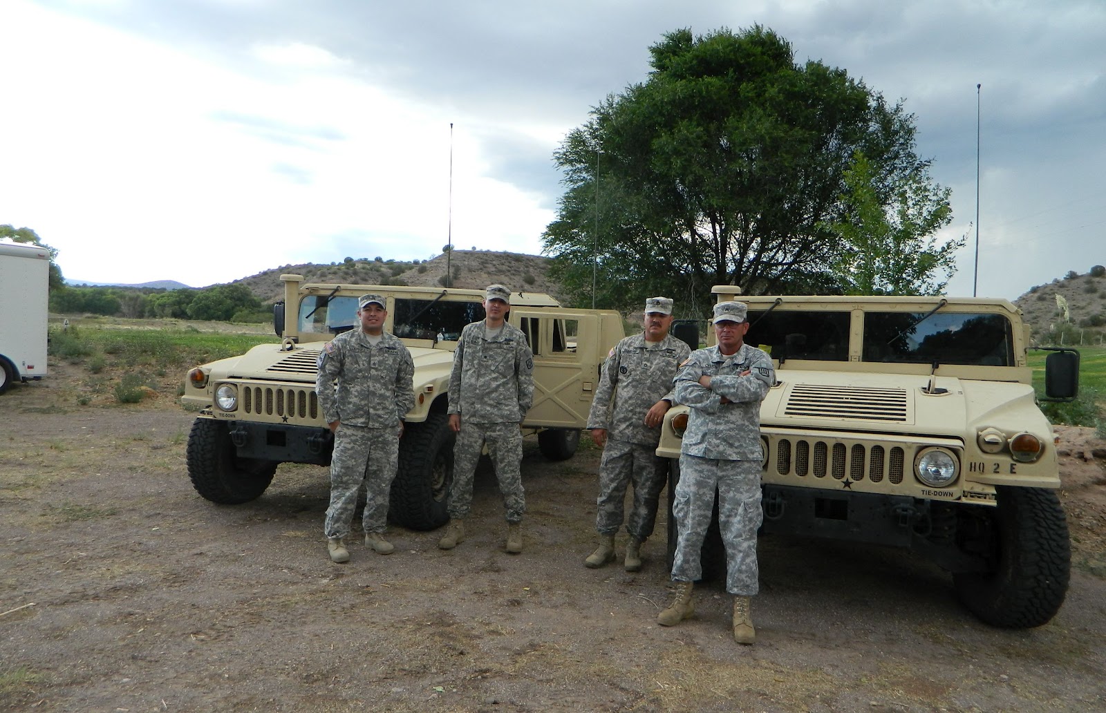
Since the Wallow fire started on May 29, 2011 the fire suppression and repair activities have been managed by a series of fire teams from throughout the United States.  Due to the great work these teams and all of the other resources assigned to the fire have done, the fire was previously turned back to the White Mountain Apache Tribe and will be turned back to the Apache-Sitgreaves National Forest on July 5, 2011 to continue patrolling, mopping up and repairing areas of the fire damaged by fire suppression activities.  For further information contact:
·         Apache-Sitgreaves National Forest at 928-333-6263 or go to their web site at http://tinyurl.com/6fzvyax.
·         White Mountain Apache Tribe at 928-338 2502 or go to their web site at http://www.wmat.us.
Giving the management responsibilities back to the forests does not mean the fire is completely out.  Smoke may continue to be visible from interior fuels burning until a season ending rain event occurs.

Today both Burned Area Emergency Response (BAER) crews and fire crews continue to remove woody debris from the East and West forks of the Little Colorado River.  Hazard tree removal continues on FR 81 in Auger Canyon, which was severely burned. “Feller-buncher” machinery and saw teams are removing dead trees that could fall across the road. The trees are placed in piles for removal at a later time.                       

High pressure over the area will continue to feed moisture into the region.   Moisture is moving over southern Apache and Navajo counties and will have the best chance for thunderstorm activity. These thunderstorms may create localized flash flooding particularly within or adjacent to the burn area.  Take appropriate precautions if a thunderstorm occurs in your vicinity.  Today’s temperatures will range from 76-85 degrees with 4-8 mph southwest wind.  Relative humidity will be near 20%.  There is a 50% chance of showers and thunderstorms in the afternoon.

Special Information:
·          Fourth of July fireworks at Sunrise Ski Area and Resort are cancelled.
·         Though the sale of ground and hand-held fireworks and their use in some locations is now legal in Arizona, please remember, fireworks are not permitted on public lands at any time.
·         The July 4th weekend is upon us and besides the hazards presented by elk and other wildlife on the roads and highways be aware of heavy holiday traffic in the area.  Watch your speed and drive defensively.  Remember that the Apache-Sitgreaves National Forest is asking that speed be held down to a maximum of 50 mph during dusk to dawn and at night.  
·         An Individual Assistance Service Center (IASC) is available for all evacuated Arizonans to access information to assist in their personal recovery from the fire. It is located at the Round Valley Public Library, 179 S Main, Eagar, Ariz. The hours of operation are: Tuesday through Thursday, July 5-7th 10 a.m.- 4 p.m. and July 8th, 10 a.m. - 2 p.m.  The facility will be closed Monday, July 4th.


WALLOW FIRE NOTICES
Road Closures -  Due to heavy fire suppression and repair activities the following roads are closed to the public:
·         US 191 (the Coronado Trail) is closed between Alpine to north of Clifton (milepost 176-253).
·         SR 261 (to Big Lake) and SR 273 (between Big Lake and Reservation Lake), remain closed.
·         Forest Road 281 is closed two miles south of its junction with US 180 but is open beyond this point to residences only.
Closures and Restrictions:
·         All Forest Service and private commercial facilities inside the road closures are not available to the public.
·         San Carlos Apache Indian Reservation: Fire Restrictions and area closures remain in effect.
·         Apache-Sitgreaves National Forests Closures and Open Areas.  Due to continued fire activity and the unprecedented levels of dry forest fuel along with dry weather, conditions exist for extreme fire danger necessitating closure of most of the Apache-Sitgreaves National Forest. Please go to the following web site for the most complete information:  http://tinyurl.com/6yflpfu.
·         For information on closures and restrictions for all public lands in Arizona go to the Public Lands Information Center web site at http://www.publiclands.org/firenews/AZ.php  or call their hotline at  (877) 864-6985.
·         Gila National Forest: A closure is in effect for the western portion of the Gila National Forest.  Call (575) 388-8201, TTY (575) 388-8497 or see http://www.fs.usda.gov/gila.
·         Fort Apache Indian Reservation:  Partial area closures are in effect for the eastside of the Fort Apache Indian Reservation. See http://www.wmat.nsn.us/.

Public Safety:   Please be aware that flooding is likely in those areas adjacent to high severity burned areas.  This may affect many of the same people who evacuated their homes in the early days of the Wallow Fire.  There is concern about roads, bridges, and culverts holding up through flooding events.  It is important to be alert and keep informed on what you can do to protect your homes and property.  While private land issues are within the County’s purview, here are some links that could be helpful to begin preparations:
·         NOAA National Weather Service: http://tinyurl.com/29fnj35 - for monitoring for flooding predictions and sign up to get      
·          e-mail alerts
·         County emergency information: http://593info.org – this web site is applicable for southern Apache and Navajo Counties.
·         For county specific information go the following web sites:  http://www.co.apache.az.us/ (Apache Co., Ariz.), http://www.co.greenlee.az.us/ (Greenlee Co., Ariz.), and  https://mylocalgov.com/catroncountynm/ (Catron Co., N.Mex.)
·         Occupational Health and Safety Administration: http://tinyurl.com/3uuxu3h - information on how to fill, and carry sandbags in a safe manner.
·         Information on flood property protection:  http://tinyurl.com/6hfues3
·         A Crisis Intervention Line (928) 333-2683 is available for residents suffering from the stress of living with fire danger. 
·         For more safety information see:  http://tinyurl.com/6zvcrck.
·         Apache County and local fire departments have begun identifying locations for staging of sandbags in anticipation of the monsoon season.  More information will be provided as locations are confirmed.
·         Information and assistance for damaged homes and small businesses can be accessed at this link: http://tinyurl.com/6a94bk5.

Tuesday, June 21, 2011

#WallowFire Update June 21, 2011 8:00 a.m.

#WallowFire Update June 21, 2011 8:00 a.m.


Location: Apache, Navajo, Graham, and Greenlee Counties, White Mountain Apache Reservation, San Carlos Apache Reservation,  Arizona;
Catron County, New Mexico
Date Started: 05/29/2011
Cause: Human - under investigation
Size:  527,774 acres total
Percent Contained: 56%
Resources: 15 Helicopter; 5 Air Tankers available; 202 Engines; 73 Water Tenders; 19 Dozers
Injuries to Date: 12
Total Personnel: 3,483
Includes 11 hotshot crews; 50 handcrews
Residences: 1,551 threatened; 32 destroyed;5 damaged
Commercial Property: 162 threatened; 4 destroyed
Outbuildings: 452 threatened; 36 destroyed; 1 damaged
Vehicles: 1 destroyed

Fire Update
  • Greer is open to the public. SR 373 that connects the town of Greer with SR 260 west of Eagar is NOW OPEN. 
  • Sunrise Resort reopened yesterday. 
  • The weather today will be sunny with a high near 81. Localized southwest up-canyon winds will influence the fire today with peak gusts between 12 and 15 mph. There will be some areas of smoke before 11am. 
  • Last night’s infrared flight showed that there was scattered heat from the southwest flank into the area of the Stray Horse Work Center. On the southern flank the fire has crossed Raspberry Creek about a half mile to the south and continues into Crooks Mesa and McKittrick Creek. In the Cedar Springs area there was a lot of heat and growth. The fire has not crossed the FS 281 road but is a half mile from Blue Camp. The fire on the eastern flank in N.M. northwest of Luna, moved some to the northwest but did not move any closer to the Tucson Electric Power distribution lines. 
  • Burned Area Emergency Response (BAER) Team members will continue working in the fire area today evaluating damage and beginning the planning process for mitigation. They will be evaluating soil and vegetation impacts. To learn more about BAER Teams, go to these sites: http://tinyurl.com/6xd42mf , http://tinyurl.com/5v9p2h5
  • Power has been fully restored to Reserve and Luna, N.M. and in Alpine and Nutrioso, AZ. Power remains out in areas north of the Blue River. 
  • Firefighters are continuing mop-up and fireline repair activities throughout the fire. With lighter winds, crews were able to make good progress and safely access areas of the fire that have been inaccessible due to high winds and dangerous snags. Rehabilitation activities include using chippers to treat the slash that was created by fireline construction operations. 
  • Crews have completed construction of control lines on the south end of the fire between McBride Canyon and Highway 191. Burnout operations have begun north of this line and will continue as conditions allow. Seeding of repaired firelines has been completed on the Fort Apache Indian Reservation.
The National Weather Service on potential flooding: The Wallow Fire burned vast portions of the White Mountains including areas of steep terrain which will make numerous locations vulnerable to flash floods and debris flows even in moderate intensity (10 – 15 minutes) rains.  Some area streams and rivers are likely to see flows beyond anything seen in decades if typical or above average rains occur. This summer, all residents near streams, rivers, or steep burned hillsides should be alert to flooding and debris flows. Residents should be aware that area roadways may become impassible due to mud, rock and debris slides or due to streams and washes overwhelming existing culverts and bridges.
 Public Safety: Smoke from the ongoing wildfires in AZ will continue to impact residents in the Wallow Fire area including southwestern N.M. For more information, link to the smoke outlook for the most recent forecast posted at: http://ge.tt/9hCpAI5.
  • A Crisis Intervention Line (928) 333-2683 is available for residents suffering from the stress of living with fire danger. 
·         An Individual Assistance Service Center (IASC) is open daily 10:00 am to 4:00 pm at the Round Valley Public Library, 179 S Main,  Eagar for all evacuated Arizonans to access information to assist in their personal recovery from the fire.
·         For more safety information see:  http://tinyurl.com/6zvcrck.
·         Apache County and local Fire Departments have begun identifying locations for staging of sandbags in anticipation of the monsoon season. More information will be provided as locations are confirmed.
 Community Meetings:
·         6 p.m. Today, Community Center in Alpine hosted by the Alpine Fire Chief. 
 Current Evacuations:
·         Evacuations remain in effect in areas north of the Blue River, AZ. and Luna, N.M.      Evacuee Information:·         An evacuation center is open at the High School in Reserve, N.M. for Luna residents.    ·         Evacuees from areas north of the Blue River may pick up their mail at the Alpine Post Office.  Pre-Evacuation Alert:·         A pre-evacuation alert continues in Apache County for Greens Peak, Hidden Meadows Lodge and surrounding areas.·         Residents in these communities are asked to remain prepared for evacuation.
Road Closures according to Arizona Department of Transportation: http://www.azdot.gov·         US 180 is closed from the junction with N.M. 12 to the AZ. state line (mileposts 20-0).
·         US 180 is closed east of Alpine to the New Mexico state line (mileposts 430-433).
·         US 191 is closed between Alpine and north of Clifton (milepost 176-253).
·         SR 261 (mileposts 395-413) and SR 273 (mileposts 383-394), main roads to Big Lake & Crescent Lake are closed.
Closures and Restrictions:·         Apache – Sitgreaves National Forest: The Springerville, Alpine, Clifton and Lakeside Ranger Districts of the Forest remain under a forest closure until further notice. A closure order is in effect for portions of the Sitgreaves side of the National Forest. Contact the Arizona fire restrictions hotline for information at (877) 864-6985 or www.publiclands.org/firenews/AZ.php.
·         Gila National Forest: A closure is in effect for the western portion of the Gila National Forest.  Call (575) 388-8201,
               TTY (575) 388-8497 or see http://www.fs.usda.gov/gila.
·         Fort Apache Indian Reservation:  Partial area closures are in effect for the eastside of the Fort Apache Indian Reservation.
                See http://www.wmat.nsn.us/.
Public Information: The public may call the following numbers for area specific fire information:·         Spanish fire information: (877)-632-6678.
·         Springerville, Eagar, and Greer: (928) 333-3412, (702) 308-3238, (702) 308-3357 or (702) 308-8227; 8 a.m. - 8 p.m.
·         Luna and Reserve, N.M., Alpine, AZ:  (575) 533-6928.South and west, including San Carlos and Fort Apache Indian Reservations: (877) 701-8201 or (928) 205-9884.
·         Information is also available at: Website Info: www.inciweb.org  Articles: http://tinyurl.com/6zvcrckTwitter: www.twitter.com/AS_NF    Flickr (photos): www.flickr.com/apachesitgreavesnf.

Tuesday, June 14, 2011

#WallowFire Note from blogmaster

#WallowFire Note from blogmaster

Today will be the final day that this blog will be updated.  The blog has been a volunteer effort on your blogmaster's part, and she has to go back to earning a living.

I appreciate the support I have received putting this blog together.  Tonight I will post a list of people I want to thank for the support I have received.  I hope I don't forget anyone, but it's been so hectic that I know I will miss some names and for that I apologize in advance.

I am gratified that people have found the information on this blog useful.  To be quite honest, aside from local input, getting information out of "official" (not local people) sources has become more and more difficult as the fire has gone on and I'm disgusted and angered about that.  I was told just yesterday that the command level emergency people who came in to take everything over determined that fire information was "confidential" until released by "official" sources.

Official sources have had delays of half a day or more in some circumstances!  The info hotline people I worked with have been gracious and apologetic about the info delays, but they have had no control.  The people in command are the ones who decided about confidentiality.  When it is your life and that of your loved ones on the line, when it's your home and your property at stake, no information about a fire should be confidential.  In my non-legal opinion, withholding timely information is a criminal act.

If you think it is important for this kind of local and immediate information to be available in times of emergency, please contact your county commissioners and your state and federal legislators.   Thank you for reading this blog.

#WallowFire - post-fire flood insurance

#WallowFire - post-fire flood insurance
Submitted by Ken Claridge


From personal experience – Most flood insurances are only covered in the event you actually live in a “flood plain”. After the flood on the Gila River in 1978, my brother and I plus several other members of my family received government loans based on losses from this flood. One of the stipulations of the load was that you were required to purchase flood insurance. 

Shortly after, my brother married and moved to Morenci, AZ. He lived a couple thousand feet above the river level. We had a storm that dumped four and three quarters of an inch of rain in less than an hour and the run off from that flooded his house situated on a steep hill. The insurance adjuster told him that the insurance was not valid in that instance because he didn’t live in a flood plain. 

People should verify with their insurance agency they will be covered where they are purchasing the insurance for prior to laying out any cash for something that may be absolutely useless and a waste of their money.